|
 Clinton Lake Sailing Association
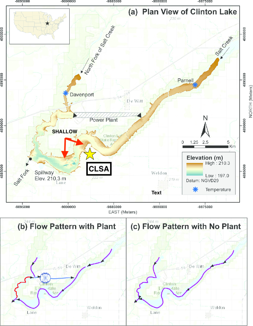
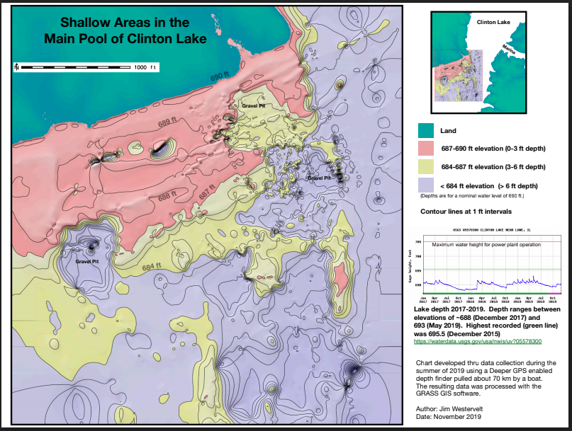
Normal pool for the approximately 5,000 acre “V” shaped impoundment is 690 feet (210.3m) above sea level. The average depth is approximately 15 feet with a maximum depth of 40 feet near the dam. The lake has an average width of 1,970 feet. Sailors should avoid the brown areas on the elevation map below. Estimated clearance at the CLSA concrete ramp is 1-4 feet while the clearance at the marina concrete ramps is upwards of 6 feet. Information about the the lake and more detailed maps can be found on the DNR Clinton Lake Access Areas and Fishing Guide.
The Legend of the Chimney
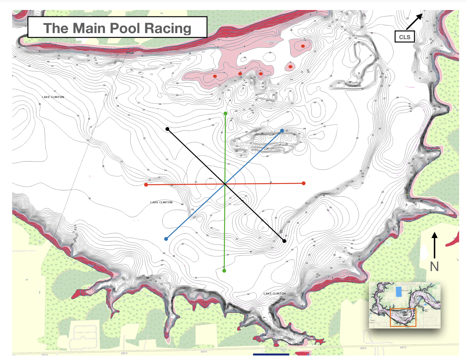
There is a notorious low area on the north side large basin that has abruptly stopped many boats and damaged more than a few keels. For decades, the area has been referred to as "the chimney". After one such incident at the 2018 Glow regatta, the issue was submitted to CLSA members on the CLSA Forum. You can read the entire conversation here. CLSA member Jim Westervelt took matters into his own hands and mapped the area with a Deeper GPS enabled depth finder pulled about 70km by a boat. The Shallow Areas in the Main Pool (shown above) is the result. If you'd like to read more about the legend, you can read Jim's article published in the Windword Newsletter.
We've never found the chimney (on purpose), but we've made progress...
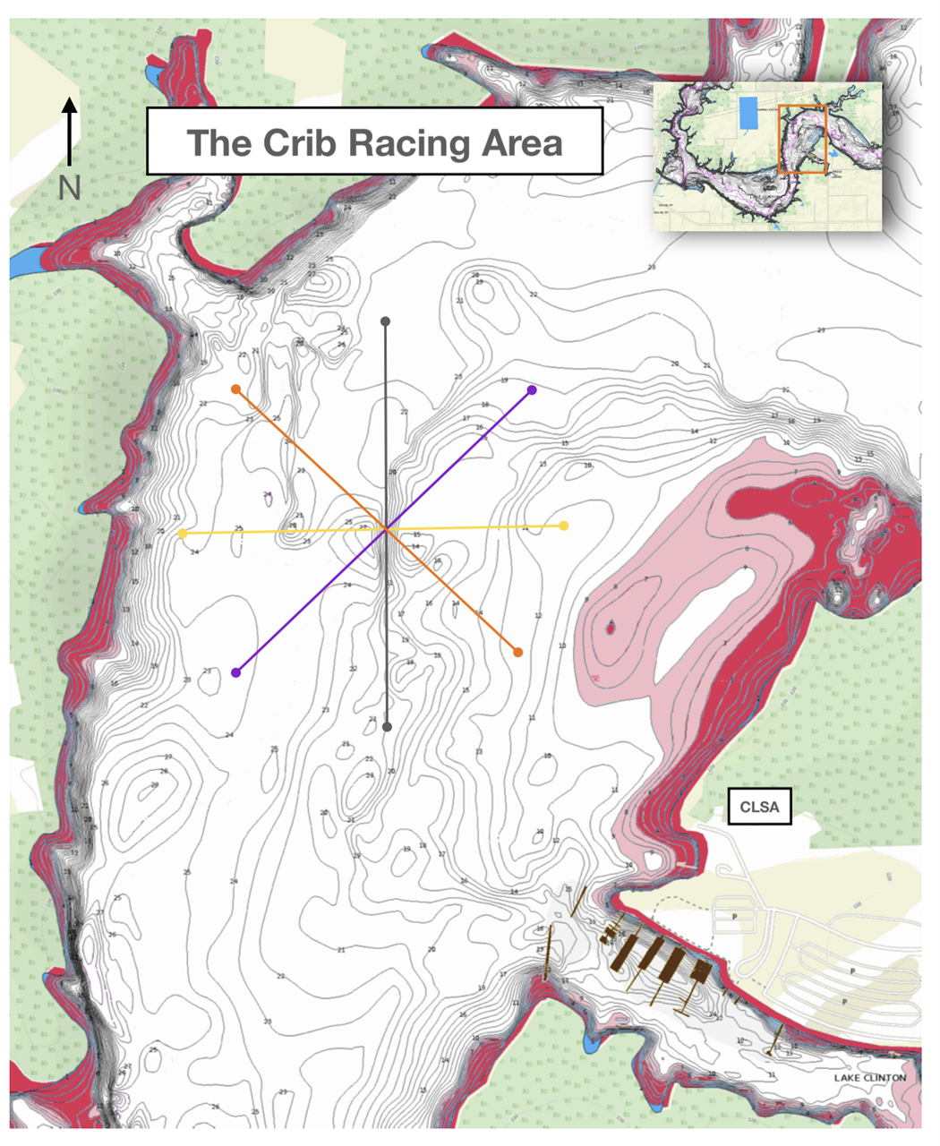
Recreational boats have much better awareness about shallow areas. We have also mapped out racing mark locations to ensure racers stay clear of the shallow areas when racing in both the Main Pool and The Crib. Race committee volunteers are now trained to use our custom google map to quickly navigate to marks when setting a race course. A link to that google map is easily accessible at the bottom of our homepage for all race committee volunteers when setting up race courses.
Click here to access a pdf file of the racing charts shown below.